Upcoming events
June 2026
This year we kick off events at the favorite Meadows Group Site! We will be in the back spot this time!
Once again, we plan on having breakfast burrito fixings in the morning, and a potluck style dinner. Be sure to bring enough food and water as it’s a pretty long way to anywhere to buy anything.
Check-in starts on Sunday after 2pm, so if you do plan on going up early maybe go check out a trailhead or the nearby lakes.
Check out will be Thursday morning, this gives us the ability to do a leisurely pack up after dinner on our usual Wednesday end time.
https://www.eventbrite.com/e/wildspaces-2026-june-tickets-1989796233097?aff=oddtdtcreator
July 2025
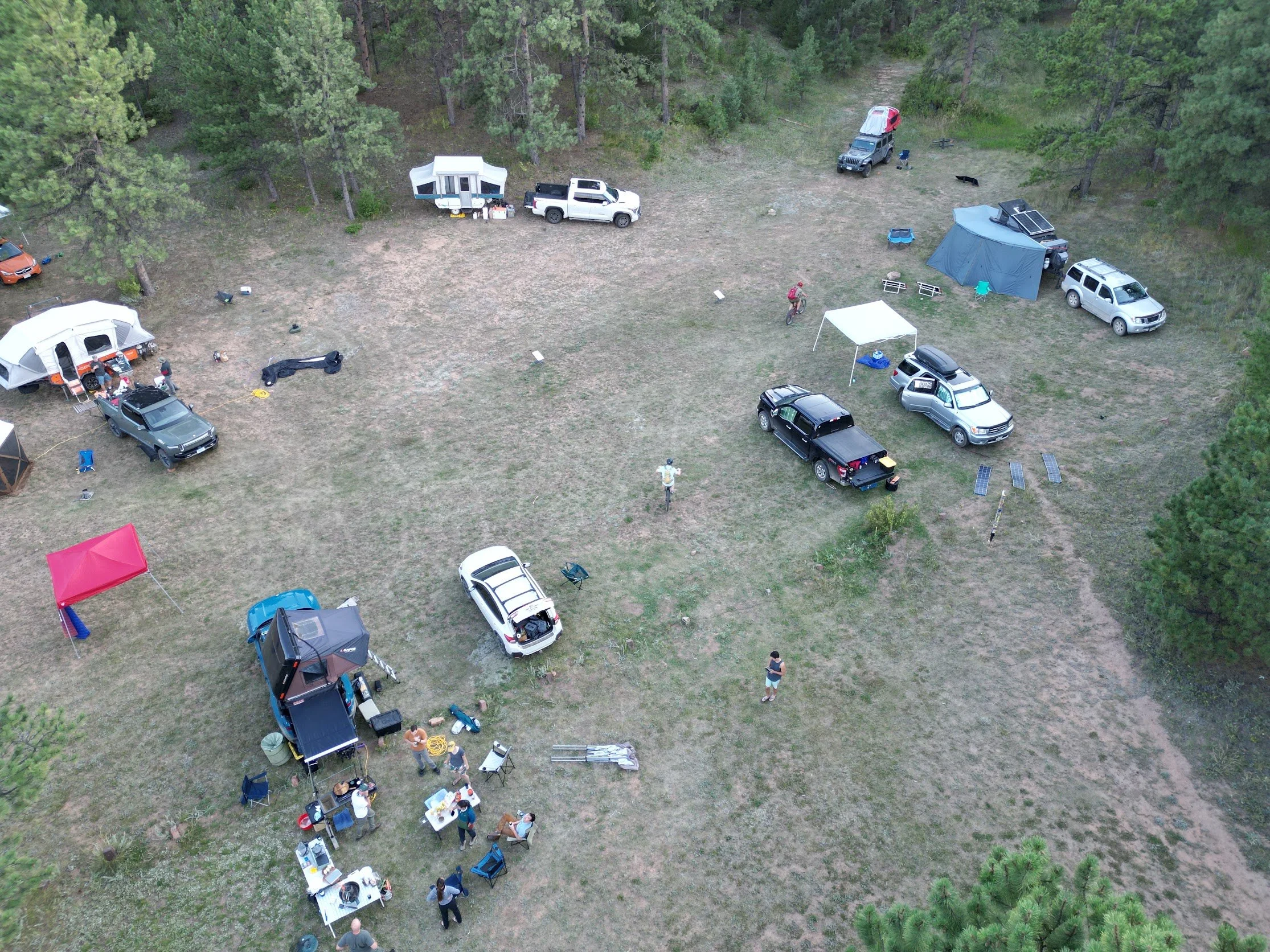
For this outing, we will be going a little more off-grid. A little further out into Pike National forest is a nice group dispersed camp site.
Things to keep in mind for dispersed camping:
There are no facilities, so you must bring your own and pack everything out with you.
Bring enough water for all your camping needs, there is none nearby.
While we are not all that far if some dire need arises, we will be more than an hour from anything so plan accordingly.
There is currently no fire ban in the area, but that could change at any time.
http://www.coemergency.com/p/fire-bans-danger.html
https://maps.app.goo.gl/jsLn5MWrtu5sh2po6
39°05'45.0"N 105°22'33.6"W
All routes include more rugged dirt roads.
Directions from Pine Junction:
Take 285 west into the mountains. Turn on highway 126 towards Pine / Buffalo Creek.
About 21 miles, Right after the Cheesman Canyon Trailhead there will be a sharp right turn onto a small dirt road ( Wigwam Creek Rd.) There are signs for Cheesman lake and Goose Creek Campground.
Follow the road about 9 miles following signs for Goose Creek campground until you pass it. Keep going about another 9 miles. The road will turn into Matukat Rd on the maps but there aren't any signs.
There will be a turnoff to the right directly after a sharp bend in the road.
Alternate Route:
The alternate way is to stay on 285 until Jefferson and turn left down Terryall Rd.
Go down Co Rd 77 ( Terryall rd ) about 33 miles and turn left on Matukat Rd.
The site is about 6 miles down on the right hand side.
This route is longer but is a much shorter amount of dirt even if that dirt is a bit rougher.
Either way, plan on about 2 hours from most of Denver Metro.
The turnoff has a loop with a couple of big dispersed sites, hopefully we get the ones further back that are a bit nicer but I will station someone in a chair or the like to point folks to where we will set up base camp.
June 2025
The first 2025 event will likely be in an easy spot to get to. Either Meadows Group Campground, or another spot that can support lots of people in non-high clearance 4x4 vehicles.

Wildspaces August '24
Registration:
https://www.eventbrite.com/e/wildspaces-824-tickets-999431405237?aff=oddtdtcreator

Wildspaces July ‘24
Wildspaces July will be our first true back country location.
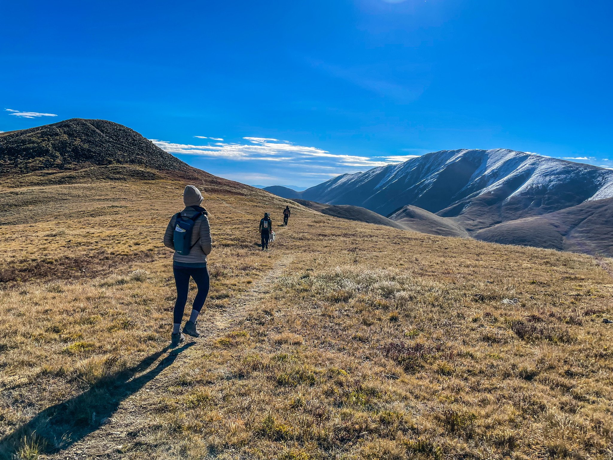
Located within the White River National Forest, this site can be accessed via the Williams Peak Road 4x4 trail. This trail is considered an “Easy 2/10” by onxOffroad. However, the trail is rocky and rutted in places, especially prior to the main gate about 1 mile in. I would recommend at least using a stock 4x4 vehicle for this road. Toyota FJ Cruiser, Tacoma, 4Runner or something similar will be fine. Subaru Drivers with limited clearance will have issues in some sections of this road. Would recommend a spotter and a radio to contact others if attempting with a low clearance vehicle. I would say it’s possible, but damage to your car may occur. The road up to the ridge climbs 2,200 feet up from the valley.
This site is absolutely gorgeous. But, it’s also fairly exposed to incoming weather patters to the west. I would expect wind and rain, and cooler temperatures up above 10,000 feet. Attendees should plan on bringing long sleeves and pants, warm clothing, rain gear, good shelter, food, water, and their own back country toilets.
There are also mosquitos in the area especially closer to the treelines. Bring long sleeves, bug repellent and any other means you might have to fight off the little jerks.
There is cell signal at the top of the ridge, both LTE and 5G.
This site is at least 70 minutes from Silverthorn, so please plan accordingly.
For EV drivers, I would highly recommend charging to 80% or more in Silverthorn before making the trip. I used roughly 10% of my pack charge on a 2022 R1T Quad getting up to the ridge on the trail.
